
Frappez la Route
The plan for Wednesday was to drop Minimus off with their friends. Simple enough, except that their friends were somewhere up near Tintagel — which, from Marazion, is not somewhere you get to quickly. Google Maps said ninety minutes. Google Maps was not wrong. Tintagel sits on the north Cornish coast, a long way from the A30, and the roads up there make their feelings about speed quite clear.
 The exact destination was uncertain until we were most of the way there. We needed an address, and the address was in the possession of people who were asleep. Eventually communications were established. Camelford, apparently. Close to Tintagel, but not quite there.
Minimus was duly delivered. I looked at the map, looked at where I was, and made the obvious decision. Tintagel was three miles away. I was already here. This was clearly a geocaching day with Tintagel on the radar.
The Village
Tintagel village sells King Arthur hard. The gift shops, the signage, the general atmosphere — all of it leans enthusiastically into the legend. This is entirely understandable. In the 12th century, Geoffrey of Monmouth named Tintagel as the place where Arthur was conceived, with Merlin’s magical assistance. Richard, Earl of Cornwall — brother of King Henry III and one of the wealthiest men in 13th-century England — then built a castle there, apparently because the Arthurian association appealed to his sense of chivalry. The castle was of no particular military value. It was built on myth. Which, when you think about it, is quite something.
 I parked in the village and walked up the main street, collecting data for a handful of multi-caches along the way. The bad news was that most of the targets were well out of the village, down roads that looked uninviting and probably weren’t worth the detour. I adjusted my plans and headed out on foot towards Bossiney instead.
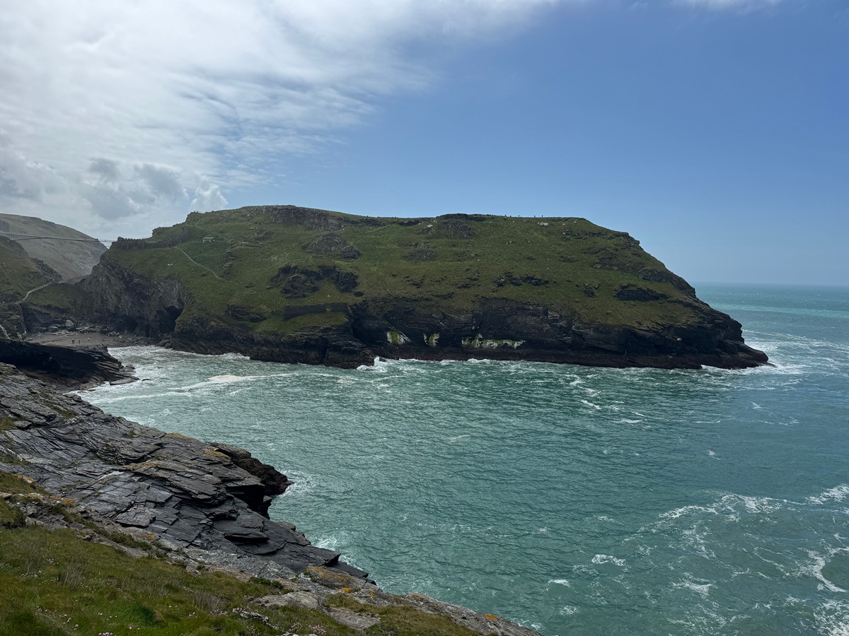
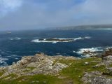
Barras Nose
The coast path north of Tintagel heads out to Barras Nose, a headland above some very serious cliffs. The cache description had mentioned taking care. This was not an exaggeration. The cache itself was a little way off the main path, on a slight downward slope. Not dangerously so, but far enough down that I was acutely aware of what was further down still.
It was also a windy day. On an exposed Cornish headland in a stiff wind, with cliffs below and a cache to find, progress was deliberate. That’s the polite word. I was moving carefully and taking my time. Which was going to be a problem, because I had a workmate meeting me for dinner in Marazion that evening and I didn’t want to be late. With one eye on the time, I made the decision to skip the series of caches that continued south along the coast. Speed and exposed cliff edges are a poor combination.
The Castle
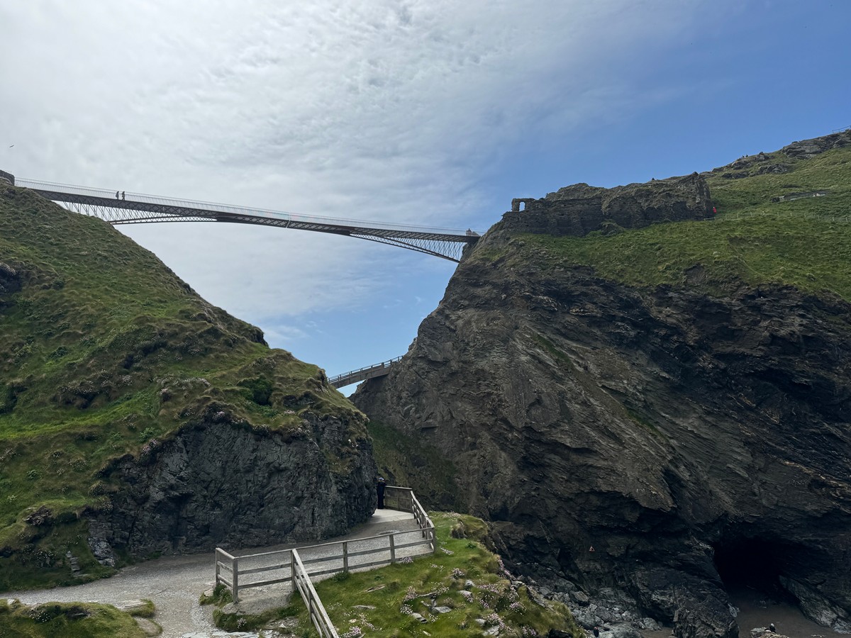
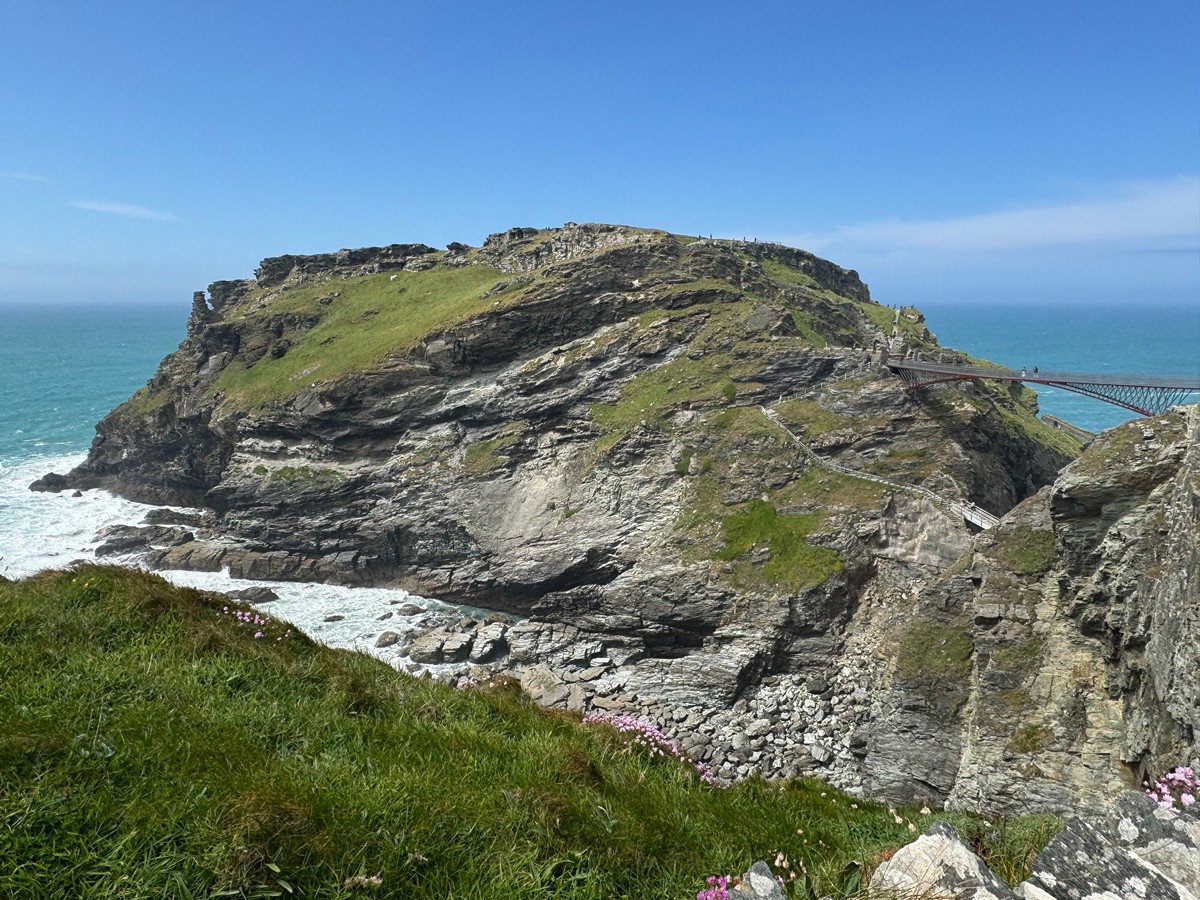
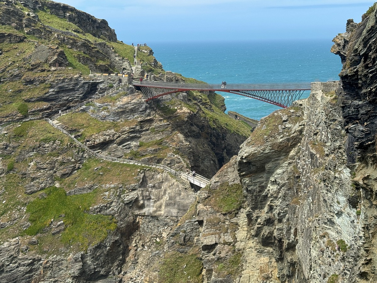 From Barras Nose I worked my way round towards the Tintagel Castle site. The castle ruins sit half on the mainland and half on a jagged headland, the two sections now linked by a wooden bridge. The headland was known as a stronghold of Cornish rulers as far back as the 5th to 7th centuries, with evidence of trade reaching as far as the Mediterranean. It’s a genuinely ancient place dressed up in Arthurian clothing. I didn’t go in — time was pressing — but there’s a puzzle cache in the area whose solution I’d worked out the night before. I spent a while trying to pin down its location. The coordinates put it on the cliff edge. The wind was persuasive. I moved on.
The Church
St Materiana’s Church is a short walk from the castle, perched on Glebe Cliff with views over the sea. It dates from around 1080, built on a site that had been a Christian burial ground since the 5th to 7th centuries. The saint herself is thought to have been Madryn, a Welsh princess of Gwent who preached in north Cornwall around 500 AD. Inside the church there’s a Roman milestone commemorating the Emperor Licinius, dating from the 4th century — found in the churchyard in 1888 and brought inside for safekeeping. It had previously been used as a coffin rest in the lychgate, which is perhaps not what the Emperor had in mind when he commissioned it.
 There was a Difficulty 5 multi-cache here. It was D5 mainly because some of the information was tricky to gather. Turns out that I couldn’t find one at all, so I sat for a few minutes playing with 10 different options to see if any of them fell on a footpath or a road. One did. It was close to the church. I’ll try that one then.
Back to Marazion
I’d seen enough of Tintagel. Deep down, a part of me wonders whether, somewhere, there’s another village called Tisagel. If there is, it’s nowhere near here.
Back at the plot, the A30 was calling me and I wanted to get back, because I had an ulterior motive. The drive south was quicker than expected. I was back in Marazion by 5pm, which left a clear hour before I needed to be ready for the evening.
I spent that hour legging it up the hill above Marazion and back. A few more caches ticked off. Efficient use of time. Possibly not what most people would choose to do with a free hour on holiday. But here we are.
The Godolphin
A quick change, then out to the Godolphin Arms with a workmate for drinks and food. The Godolphin sits right on the seafront at Marazion, with views across to St Michael’s Mount. It’s a reliable choice. It was good again. Some places earn their reputation on repeat visits, and the Godolphin is one of them.


